My Stocking, Wales and Hill family lines converged in these two London streets on and off for more than two decades from the 1880s onwards. The street names seemed interchangeable and their history was apparently steeped in scandal. But what were the houses, the neighbours and the area like? Do family and other photos show these roads, or am I reading too much into them?
The first clues in the records
The very first reference to Bowles Road in my family records is on the birth certificate of Harriet Elizabeth Stocking, born on 14 April 1879 at 43 Bowles Road. She was the fourth child of my 2xgreat grandparents James Thomas Stocking and Alice Mary, formerly Wales,
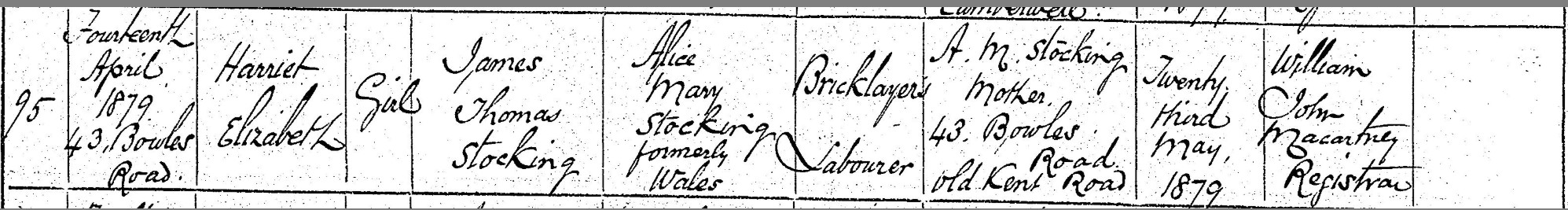
Extract from birth certificate of Harriet Elizabeth Stocking (GRO)
The births of their two previous children, including my great grandfather James Aaron Stocking, took place at 30 Bermondsey New Road in 1876 and 1878. So it seems that the growing family moved from Bermondsey to Camberwell in the months between January 1878 and mid-April 1879, perhaps in search of larger digs, cheaper rent, a preferred school for their children or to be closer to other family members. The houses had only been built a few years before. Did James find work on site as a Bricklayer’s Labourer while they were living in Bermondsey, and decided to move in?
Their eldest daughter, Alice Caroline Stocking, was admitted to nearby Rolls Road Infants School on 26 April 1880, when she was five years old. The family address is 43 Bowles Road.

Extract from Rolls Road Admission and Discharge Register for Infants (Ancestry)
A year later, at the time of the 1881 census, James and his wife Alice and their five young children are enumerated at 43 Herman Road. Same number, different name. Enumerated in a separate household at 43 Herman Road are Alice’s parents – Aaron Wales, a Saddler and Harness Maker originally from Norfolk, and his wife Catherine, nee Stoney – and five of her younger siblings, aged eight to 21.
Did Bowles Road become Herman Road, or was it a coincidence that their addresses a year apart are at no. 43? Many records over the following two decades show that both names were used for the same properties, and the layout of the roads – on a site that was historically referred to as the ‘Leg o’ Mutton’ Estate because of its shape – may have influenced that. Although school registers and other records show the family moved away around 1885 to Victory Place and Astley Road, they had returned by October 1889, this time to 44 Bowles Road.
Do family photos show Bowles/Herman Road?
In 1910-1915, a few years after the widowed James moved with his youngest children to Beechfield Road, Catford, the so-called ‘Lloyd George Domesday Survey’ was undertaken. Its purpose was to identify the rateable value of every property in England and Wales. The entry for 44 Herman Road notes that it is now called Bowles Road (!). The property is owned by Camberwell Borough Council, and its description (identical to others in the street) is as follows:
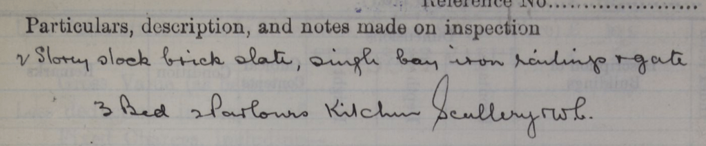
Extract from Lloyd George Domesday Survey (The Genealogist)
A recent contact via this blog kindly shared family photos which are said to be taken “near the Old Kent Road”. Could these be of the Stocking family home at 44 Bowles Road / Herman Road?
On the left are my 2xgreat grandparents James and Alice Stocking. The baby could, just possibly, be Susan Caroline Stocking, born in Camberwell at the end of 1896. Her parents would have been 43 and 39 … but maybe they look older? They had three more children between 1898-1902, completing a total of 19 children, so the baby could be one of them. In the photo on the right is Alice with an unknown lad; this photo gives a better view of the house, with its brick frontage, curved brick edged door opening and arched lintel, two windows upstairs and one below, both with decorative window boxes, and a wooden picket fence and gate at the front. I can’t decide if it’s earlier or later than the photo on the left.
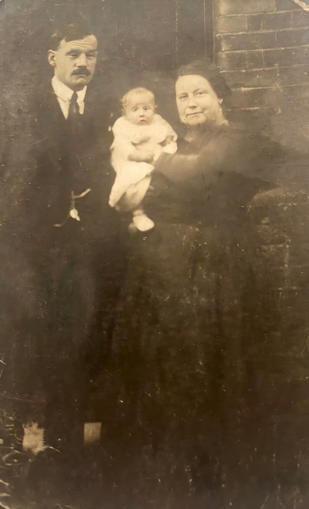
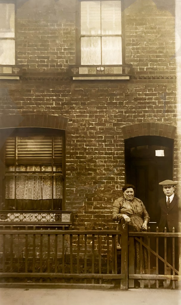
However, does this really count as a ‘single bay’, as described in the Lloyd George Domesday Survey? And clearly there’s a picket fence, not iron railings. So perhaps I am being hasty in my excitement. What do you think?
In 1881, there were 14 people at 43 Herman Road, including seven children under ten years. That must have been quite a squash, with just three bedrooms and two parlours, sharing a kitchen, scullery and WC.
Bowles Road on old maps
Bowles Road and Herman Road no longer appear on modern maps and did not seem to exist on earlier ones until the late 1870s/early 1880s. From newspaper articles – below – it seems they were built in the mid-1870s, so the Stockings moved into relatively new houses towards the end of that decade.
I have circled their approximate location in blue on the extract from an 1871-1874 map below. To the north is the Old Kent Road which runs due East via the Old Kent Road Bridge over the Grand Surrey Canal, which was constructed from the early 1800s. Close by are the gasometers of the Southern Metropolitan Gas Company. The Canal runs along the southern perimeter of the site, with a Flour Mill off Mill Street, and a Whiting Works facing the Canal; an industrial landscape, with a scattering of what look like residential properties in Somerset Buildings, within the circle. See the original map here.
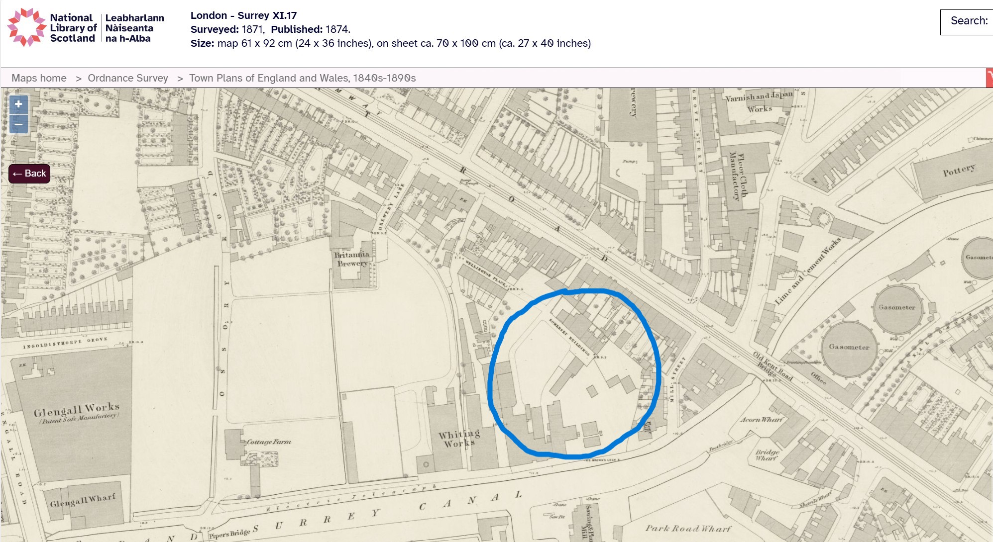
Extract from London-Surrey X1.17 map surveyed 1871, published 1874
(with permission from the National Library of Scotland)
The first map I’ve found showing development on the site is Whitbread’s New Map of London and its Environs of 1881. Again, I have circled the site in blue on the extract below. See the original map here.
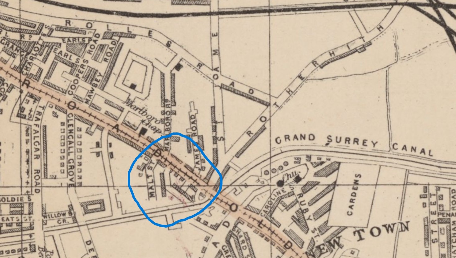
Extract from Whitbread’s New Map of London and its Environs, 1881.
Published with permission of The National Library of Scotland.
The above map has less detail, but you can just see, to the right of Malt Street, that there are two dark rows representing buildings in a vaguely triangular alignment. Bowles Road is the row to the left, not quite reaching the edge of the Grand Surrey Canal, while Herman Road is the diagonal one on the right, parallel to the Old Kent Road.
This later map, from 1893, shows the ‘Leg o’ Mutton’ shape of the two roads more clearly, with Bowles Road now carrying tram lines from the Old Kent Road into the Tramways Depot on the canalside and Herman Road running diagonally towards it, parallel to Old Kent Road.
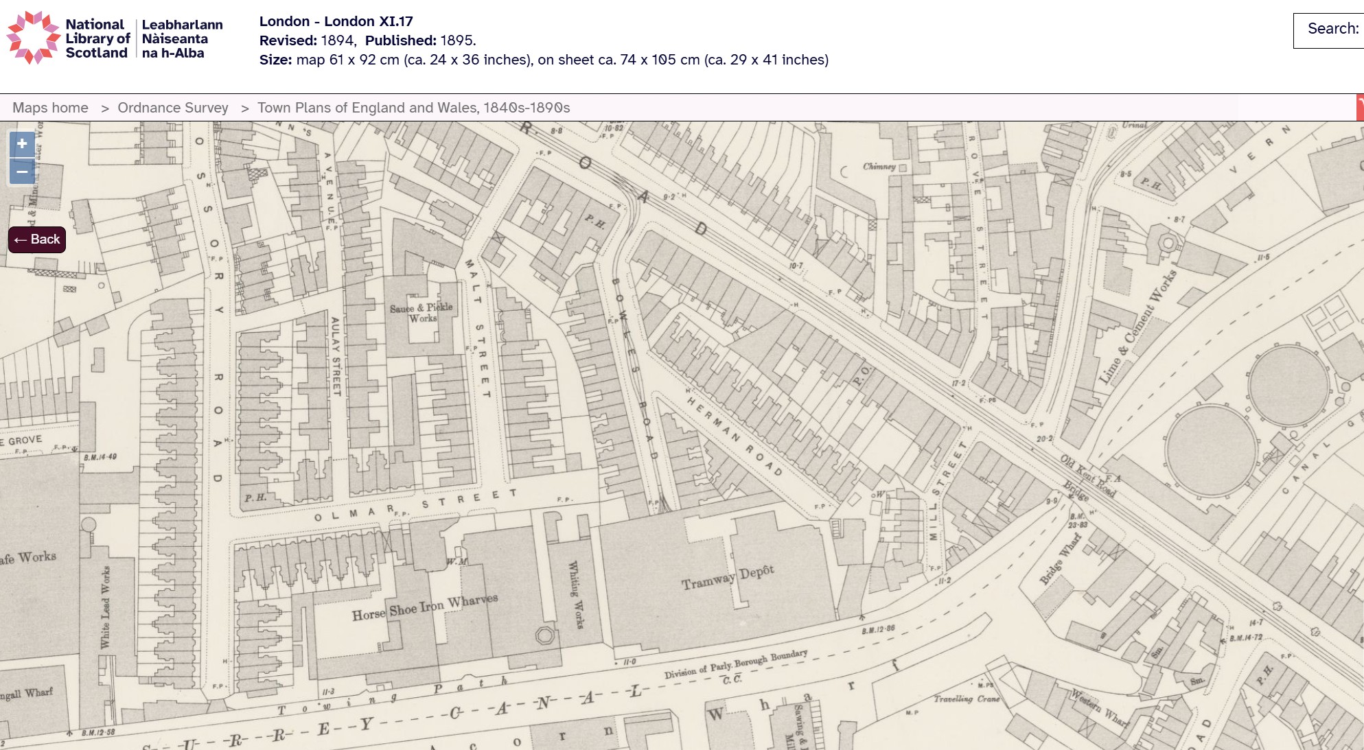
Extract from OS map published 1895, London X1.17.
With permission of the National Library of Scotland.
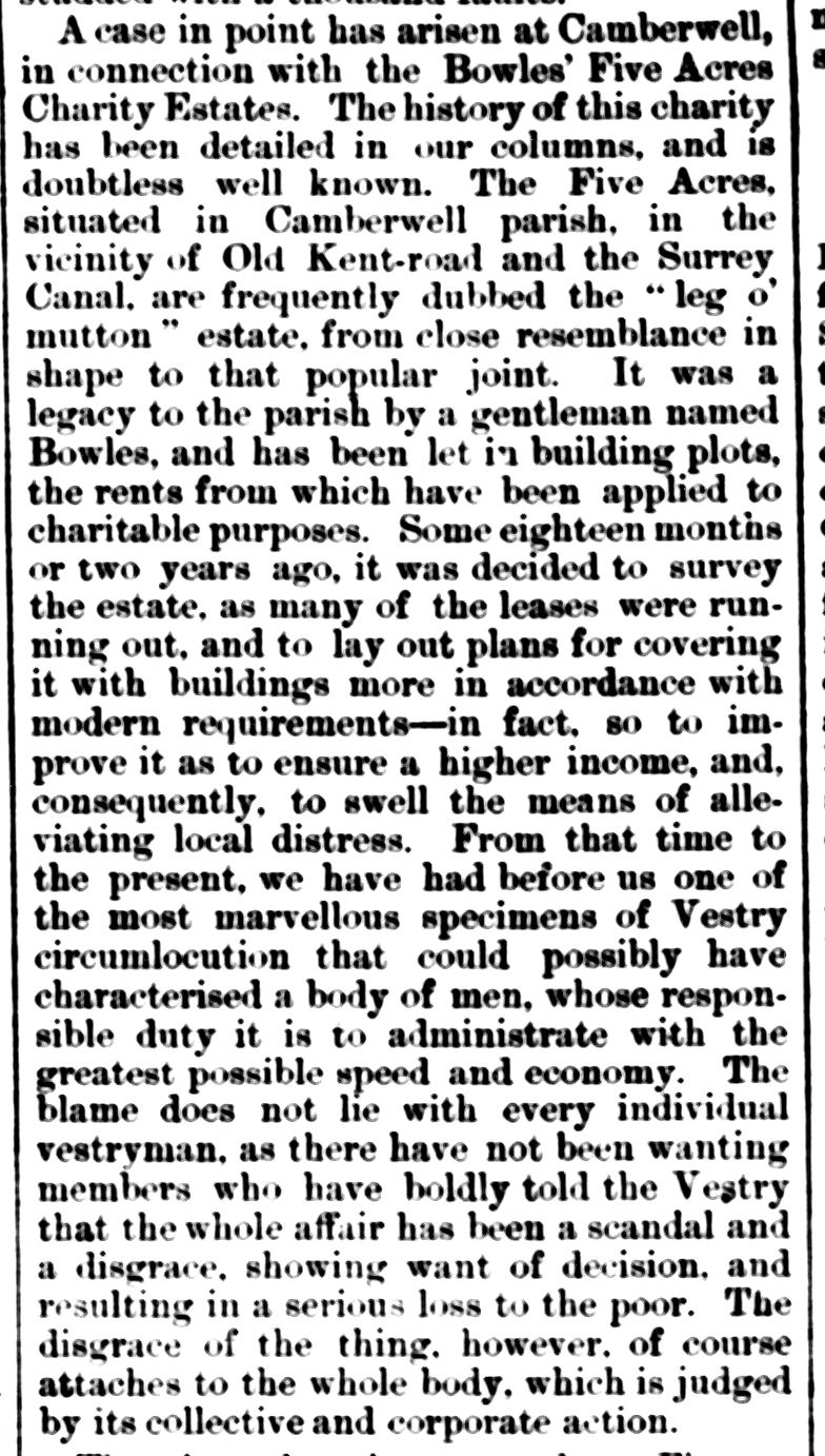
‘Circumlocutions of the Vestry’ and the history of the ‘Leg o’ Mutton Estate’
I searched the British Newspaper Archive at FindMyPast, hoping to find some insights into the area and its people at the time my families were living there. From the early 1880s, newspapers such as the South London Press featured adverts for rooms to let, or for services (and in one case, a missing person) sought or provided by residents. But my searches also revealed the scandal of the development of what was known as Bowles Five Acres, or the ‘Leg o’ Mutton Estate’. This was a site managed (or mismanaged) by the Camberwell Charity Estates where housing for let was eventually built, creating Bowles Road and Herman Road.
June 1873 saw adverts published in the South London Press for the ‘last remaining plots of building land’ on the Old Kent Road, Canal Bridge, Bowles Five Acre Estate. However, three years earlier, local newspapers gave blow-by-blow accounts of arguments amongst the Charity Estates’ Trustees and the Camberwell Vestry, and the resulting waste of effort and money.
The South London Press took up the baton on 21 May 1870 with a succinct history of the land in question:
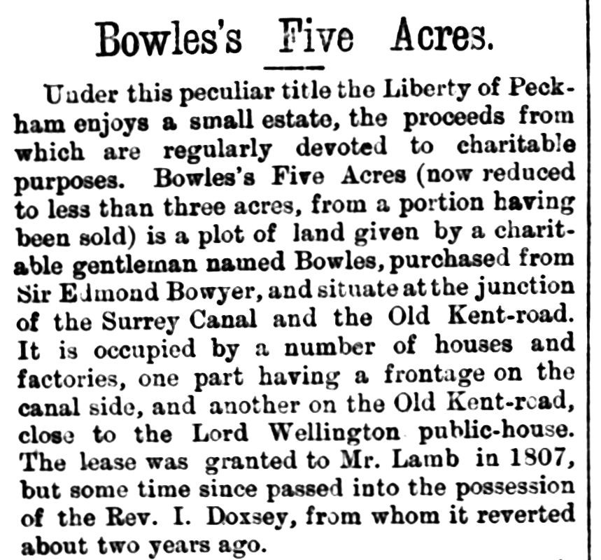
Extract from South London Press, 21 May 1870 (FindMyPast)
However, the reporter then goes on the attack, noting the low returns currently derived from the properties on the site – which should be distributed to the poor – adding:
The past management of the estate has not been all that could have been desired, for the property has, to some extent, gone to decay, and a portion of the land has been permitted to lie idle.
The article goes on to decry the Vestry’s earlier proposals for the site, which would raise very little income. It seems that a Committee established by the Vestry had recommended demolition of the ‘weekly houses’ on the site, “which have been condemned by the Sanitary and Sewer Committee of the Vestry as being unfit for habitation” and to “parcel the land out in plots for letting”. Weekly houses were, perhaps, rented by the week and saw significant turnover of tenants who would have cared little for the properties. The suggestion is that longer term tenants would take more care of their newly-built abodes. The Committee had held a competition for plans to develop the site, and 35 proposals had been received. Description of these is followed by accusations of ‘jobbery’ – insider dealing where the names of the submitters had leaked out:
On these plans the Vestry will have to decide and we trust that merit alone will guide the arbiters of an estate of this character, and that neither jobbery nor favouritism – and some foreshadowing of the latter, is, we are sorry to say, already visible – will be suffered to have any weight in the arbitration.
Plans were finally approved by the Vestry at the end of March 1871, but the irony that these were little modified from those they had proposed over a year earlier was not lost on the South London Press, which launched a scathing attack on 8 April 1871 under the headline BOWLES’S FIVE ACRES: A TRIUMPH OF CAMBERWELL CIRCUMLOCUTION:
Extract from South London Press, 8 April 1871 (FindMyPast)
Do later photos help identify the houses?
In addition to the 1910-1915 Lloyd George Domesday Survey description of the houses in Bowles Road/Herman Road, I was excited to find aerial photos of the site taken in the 1930s at the Britain from Above website. These show Bowles Road, Herman Road and the surroundings close to the gas works and the Grand Surrey Canal – an industrial area by then in decline. See the original image here.
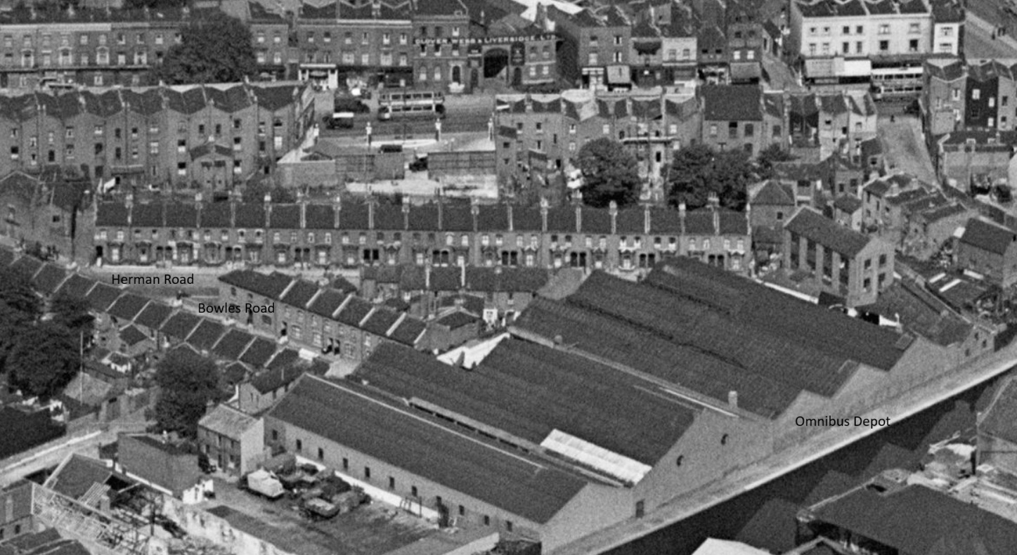
Aerial Photo 1931: Camberwell, The Grand Surrey Canal and industrial buildings off Latona Road and environs. Britain from Above. (My annotations)
The houses on Bowles Road look similar to those in the family photos, whereas those on Herman Road appear to have bay windows, although it is impossible to zoom in close enough to really see the detail. According to the map provided by The Genealogist showing properties in the Lloyd George Domesday Survey, no. 44 Herman Road was fifth from the end (left of the photo). The houses were numbered in sequence L-R as 48-30; just four houses faced them, numbered 25-28. The roads have probably been widened by this time to accommodate more cars; there are no railings or fences outside any of them. However, this may just be wishful thinking, and the family photos may have been taken elsewhere!
Overfull houses, ‘purple’ streets
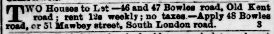
Homes on Bowles Road continued to be advertised for rent during the early 1880s, this example from the South London Observer, 9 July 1884 (FindMyPast):
However, this was not long before the Stockings moved from Bowles Road to Victory Place, close to St Mark’s Church, Cobourg Road, where three more of their children were christened; I wonder if there was a general exodus, leaving several properties empty? Whatever the reason, school and other records show that the families were once again living in Bowles Road by the Summer of 1889.
The 1891 census shows that the three families were close neighbours in Bowles Road, and that each two storey, three-bedroomed house held a large number of people, where the ‘two parlours’ were probably also used as bedrooms or bedsitting rooms:
- No. 25 Bowles Road: John Hill, wife Elizabeth and five children aged 6 months-15, occupying five rooms and sharing the house with a widowed charwoman, Rebecca Wilkinson, her 12 year old daughter, 6 week old son and two lodgers in their twenties, all in two rooms.
- No. 42 Bowles Road: Alice’s brother Benjamin Wales, wife and eight children aged 3 months to 15 years, occupying four rooms and sharing the property with William Ruth, a Foreman, his wife and adult niece, in two rooms.
- No. 43 Bowles Road: Alice’s parents Aaron and Catherine Wales, three of their adult children, and a two year old grandson, sharing the house with widowed needlewoman Eliza Maddison and her adult daughter, a machinist.
- No. 44 Bowles Road: James and Alice Stocking with 11 children aged 6 months-16 years, sharing the property with another of Alice’s sisters, Emma Sargeant, her husband John and their four children aged 1-7.
From the late 1890s, however, family addresses switch between Bowles Road and Herman Road:
- 1 July 1898: Rolls Road School register – Richard Henry Stocking son of James, 44 Herman Road
- 4 January 1899: Baptism of Alfred Edmund Ilott Stocking, son of James and Alice, 44 Bowles Road
- 25 December 1899: Marriage of Harriet Stocking and Alfred Bishop, both of 44 Herman Road
- 8 January 1900: Rolls Road School register – Annie daughter of James, 44 Bowles Road
- 3 June 1900: Marriage of James Aaron Stocking of 44 Herman Road, and Susan Caroline Hill, 25 Herman Road
- 25 December 1900: Marriage of Alice Caroline Stocking to Bill Schofield, both of 44 Bowles Road
Charles Booth’s poverty map: Bowles Road and Herman Street
In 1899, social reformer Charles Booth walked around the Bowles Road/Herman Street [sic] district with policeman George H Duckworth, describing the levels of wealth and poverty and the employment of residents, in order to update his ‘poverty map’. This was a colour-coded map of London accompanying his work “Charles Booth’s Inquiry into Life and Labour in London (1886-1903)”. His notebooks and maps have been digitised as part of the Charles Booth’s London project at the London School of Economics, and provide fascinating insights into London life as Victoria’s reign came to a close.
Both streets were described as ‘purple’, ie some residents comfortable, others poor. In his general notes on the area, which included many surrounding streets, he writes:
Those who live in this district work in it. For men and women there are the large ginger beer … and mineral water works belonging to R White … for first class labour there is tramway work under the LCC. For poorer labour there is canal work and lime kilns and horse tending and for rough skilled labour there is sheepskin dressing in Herring St and Goldie St, and for skilled womens work there is the large collar and cuff works in the Cobourg Road”
Extract from Charles Booth’s London, Notebook BOOTH/B/365 pp 201-205
Booth also adds that the policeman was previously stationed in Clerkenwell, and the criminal classes were much more vicious than those around these streets in Walworth.
The 1901 census has the families enumerated in Herman Road again, but other records show that the addresses continued to switch between Herman and Bowles Roads until the middle of 1904, when Herman Road prevails.
With three large families living in the ‘Leg o’ Mutton’ for over two decades, it is not a surprise that they celebrated many births and marriages, and mourned a smaller number of deaths. At least two generations of the family had 17 children christened at St Philip’s, Avondale Square or St Mark’s, Cobourg Street, and seven brides or grooms were married in the same churches, their home addresses all shown as Bowles Road or Herman Road.
Three babies and one teenager died there, and in 1907, three deaths amongst the older generation may have prompted a move to Beechfield Road, Catford. Aaron Wales died on 19 February, Alice Mary Stocking died on 27 February and Catherine Wales, widow of Aaron, died on 18 November 1907. Some of the younger generation are still recorded at Herman Road or Bowles Road in electoral registers and later censuses, so the family presence persisted beyond WW1.
Main Sources:
- 1881-1901 censuses (Ancestry, FindMyPast, The Genealogist)
- Rolls Road School Admission and Discharge Registers (Ancestry)
- Mawbey Road School Admission and Discharge Registers (Ancestry)
- Birth, baptism, marriage and death certificates (Ancestry, GRO)
- National Library of Scotland OS and other maps of London
- Lloyd George Domesday Survey (The Genealogist)
- Britain from Above aerial photos 1930s
- Family photos, with thanks to Angela McKay, Brendan Nolan and Valerie Bradley
